Death Valley
By Julian Bialowas & Daniel Tomko·Updated April 2026
Death Valley requires a specific kind of respect that most national parks don't. It holds the record for the highest reliably recorded air temperature on Earth—130°F at Furnace Creek in 2021, a reading that is not an anomaly but a data point in a consistent pattern. The park sits 282 feet below sea level at Badwater Basin, ringed by mountain ranges that trap heat like a furnace and block rain. Annual precipitation averages less than two inches. You are entering a system that is actively hostile to human life for roughly five months of the year, and astonishingly, heartbreakingly beautiful for the other seven.
The payoff for timing your visit correctly is a landscape with no peer in California. Mesquite Flat Sand Dunes at dawn, when the light rakes across the rippled sand and you might be the only person there. The Artist's Drive palette of volcanic minerals—purples, greens, reds, yellows—painted across a hillside that looks like someone spilled art supplies. Badwater Basin's hexagonal salt polygons stretching to the horizon under a full moon. Zabriskie Point at sunrise, when the eroded badlands turn orange and gold. These are not Instagram clichés—they are one-of-a-kind experiences that require you to be here in person.
Death Valley is also the largest national park in the contiguous United States at 3.4 million acres, and the road network barely scratches the surface. The main corridor along Highway 190 connects the major campgrounds and viewpoints. But Racetrack Playa—where rocks move across the desert floor on their own, leaving visible tracks—requires a 27-mile one-way drive on a rough dirt road. Titus Canyon is a one-way slot canyon you drive through in a vehicle. The park rewards people who look beyond the visitor center map.
Top Campgrounds Near Death Valley

Baker RV
Baker RV is a no-frills but convenient stopover if you're driving the I-15 corridor between Las Vegas and Southern California. It's walkable to the Baker Store and Los Doritos for a decent meal, handles rigs up to 40 feet, and the hosts are responsive — exactly what you need when you just want to break up a long drive.
Book on Hipcamp
Boulder Creek RV Resort on Hwy 395
Boulder Creek RV Resort is a solid basecamp for tackling Mt. Whitney and the surrounding Eastern Sierra trails, with a pool, clubhouse, clean hot showers, fire rings, and friendly staff to round out the experience. If you're planning multiple days of hiking, this place earns its keep.
Book on Hipcamp
Furnace Creek Campground
Furnace Creek is the main hub of Death Valley — convenient to park attractions and genuinely enjoyable in the cooler winter months — but come prepared: the tire-on-concrete rule for RVs is strictly enforced, shade is scarce, and summer heat is no joke. It's a well-worn oasis that works best as a launch pad rather than a relaxation destination.
Visit Official Site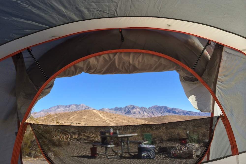
Mesquite Spring Campground
Mesquite Spring is the quiet, dark-sky reward for those willing to drive deep into Death Valley — no RVs, minimal crowds, and some of the best stargazing in the park, especially near Ubehebe Crater and Scotty's Castle. Snag a lower-loop site early if you're tent camping, and dress for cold nights even in late fall.
Visit Official Site
Wildrose Campground
Wildrose is the cool, shady escape within Death Valley—sitting at elevation among juniper trees means real relief from valley heat, though wind can be a factor. It's free, first-come-first-served, and the Charcoal Kilns just seven miles up the road make it a genuinely worthwhile base.
Visit Official Site
Emigrant Campground
Emigrant is a no-frills gravel lot with zero shade, but it's free, has flush toilets, and delivers big valley views and exceptional night skies—a legitimately useful stop right off Highway 190. Just stake your tent down hard; sandstorms are a real possibility.
Visit Official Site
Mahogany Flat Campground
Mahogany Flat sits at 8,200 feet on a ridgeline with a staggering view of Badwater Basin below, and it's the trailhead for the excellent Telescope Peak hike—but the last stretch of road genuinely wants high clearance or 4WD, and nights get cold even by Death Valley standards. Reviewers have made it in a Kia and a Honda Element, but you'll feel it.
Visit Official SitePlanning Your Death Valley Trip
Best Time to Visit
November–February: Peak season and rightfully so. Daytime highs in the 60s and 70s, nights in the 40s. Every campground is open and filling up. The light in winter is extraordinary—low angle, long shadows, the badlands at Zabriskie Point glowing in the afternoon. This is Death Valley at full power.
October and March: The shoulder months are excellent. October transitions from impossible to magical, and by mid-October you can camp comfortably. March is the last good month before heat starts building—and a good rainfall year can produce wildflower blooms across the valley floor, an otherworldly sight.
April: Transitional. Early April is manageable; late April starts pushing 100°F on bad days. If you go in April, plan to be done hiking by 9am and back in the shade or air conditioning by noon.
May–September: Life-threatening heat. Temperatures regularly exceed 120°F. The park is technically open but most campgrounds at lower elevations are dangerous. Stovepipe Wells Village and Furnace Creek still operate (they have air conditioning), but hiking is reserved for the Charcoal Kilns area or Telescope Peak, both at high elevation. The NPS actively discourages daytime hikes from May through September and carries out regular heat-related rescues. Only experienced desert travelers with extensive heat preparation should visit in summer.
What to Know Before You Go
Heat danger: This is not a warning to be skimmed. People die in Death Valley every year from heat exposure, often in circumstances they believed were manageable. Even in spring shoulder months, temperatures can spike unexpectedly. The park's rule of thumb: if it's above 100°F, don't hike. Carry a minimum of one liter of water per hour of hiking. Do not attempt any trail below 3,000 feet elevation between May and September. Tell someone your plans before entering remote areas.
Water: Potable water is available at Furnace Creek (the main hub with a visitor center and lodge), Stovepipe Wells Village, and Panamint Springs Resort. Mesquite Spring Campground has water seasonally. Most backcountry areas have no water at all. Fill every container you have before leaving paved roads—your car also needs water in the radiator, and breakdown in a remote canyon with no cell service is a survival situation.
Gas: Death Valley is enormous. Gas is available at Furnace Creek, Stovepipe Wells, and Panamint Springs—and it's expensive (often $1.50–2.00 more per gallon than Barstow or Ridgecrest). Fill up before entering if you can. The nearest towns with competitive prices are Beatty, NV (east side) and Ridgecrest, CA (west side). Running out of gas in a remote canyon in summer heat is not an inconvenience—it is a medical emergency.
Cell service: Nearly zero inside the park. Furnace Creek has some coverage, and Stovepipe Wells occasionally. Anywhere else, assume you are unreachable. Download offline maps before entering and file a trip plan with someone you trust.
Fire restrictions: Campfires are permitted only in the fire grates at developed campgrounds. Given the extreme dryness, fire bans are common—check conditions at nps.gov/deva. Campfires are categorically prohibited in backcountry areas.
Nearby Activities
Badwater Basin (0.5–3 miles): Walk out onto the salt flats at 282 feet below sea level. The easy version is a half-mile to the main salt polygon formations; serious walkers go two or three miles out to where the flats feel truly infinite and the crowds disappear. Go at sunrise or under a full moon—the white salt reflects light in a way that makes the basin glow.
Mesquite Flat Sand Dunes (variable): The dunes near Stovepipe Wells are the most accessible in the park and worth every step. Go at first light—the low-angle sun creates dramatic shadow lines across the rippled sand and the footprints from the previous day's visitors have been erased by wind. Bring shoes you can remove, because sand in your boots makes the descent miserable.
Zabriskie Point: A five-minute walk from the parking lot delivers one of the great badlands views in the American West—layered mudstone and volcanic ash eroded into a landscape of ridges and gullies that looks completely alien. It's crowded at sunset; try dawn instead. You'll often have it entirely to yourself at 6am.
Artist's Drive (9 miles, one-way): A one-way loop through the Black Mountains that passes the Artist's Palette—a hillside where volcanic minerals have oxidized into purples, greens, pinks, and yellows that look physically impossible. The light at 3–4pm in winter is ideal. The road is passable for regular vehicles but too narrow for RVs and trailers.
Mosaic Canyon (4 miles round-trip): A slot canyon accessible from Stovepipe Wells that narrows to shoulder-width in places, the walls polished smooth by ancient floods into marble-like patterns. The first mile is the best—narrow, polished, otherworldly. After that it opens up into a more conventional canyon. Easy hiking, suitable for most fitness levels.
Telescope Peak (14 miles round-trip): The high-elevation escape hatch when the valley floor becomes uninhabitable. The summit sits at 11,049 feet—you can see Badwater Basin below and Mount Whitney to the northwest. Strenuous, requires starting early, and can have snow on the trail from November through April. The view of the entire Death Valley system from the top is staggering.
Frequently Asked Questions
Which Death Valley campground should I stay at?
Furnace Creek Campground is the main hub—136 sites, close to the visitor center, flush toilets, and access to everything in the valley. It's central, convenient, and fills up fast from November through February (reservations required, book at recreation.gov). Sunset Campground nearby is reservation-free but RV-heavy and exposed. If you want the best atmosphere, drive north to Mesquite Spring Campground near Scotty's Castle—it's quieter, has water, and feels like real camping rather than a parking lot. Stovepipe Wells is mid-park with hookups available for RVs. For solitude and dramatic scenery, Emigrant Campground (free, no water) sits at 2,100 feet on the west side and is often overlooked.
Is Death Valley safe to visit?
Absolutely—in the right months with the right preparation. October through April, Death Valley is one of the most spectacular places in California, and the main hazards (heat stroke, dehydration) are easily managed with basic precautions. The danger is real in summer: average July highs exceed 116°F, and the park records heat fatalities most years. The rule of thumb used by experienced desert visitors is simple: if the temperature is above 100°F, don't hike below 3,000 feet elevation. Stay in your air-conditioned car or lodge during the hottest part of the day. Carry more water than you think you need, always.
How many days do you need for Death Valley?
Two nights gets you the essentials: Badwater Basin, Zabriskie Point at sunrise or sunset, the Mesquite Flat Dunes, and Artist's Drive. Three nights is the sweet spot—add Mosaic Canyon, a proper dunes excursion at dawn, and time to drive north to Scotty's Castle (currently closed for flood repair) or the Racetrack Playa if you have a high-clearance vehicle. Four nights or more and you're getting into Telescope Peak, the Eureka Dunes, and the far reaches of the park that most visitors never see. Even a single night during the right season is worthwhile—arrive after dark and stand outside your tent. The stars alone justify the drive.
What should I pack for Death Valley camping?
Water is the non-negotiable: bring more than you think you need and fill every container at Furnace Creek or Stovepipe Wells before heading anywhere remote. A car thermometer is useful for reality-checking temperatures before committing to a hike. Layers matter more than people expect—winter nights drop into the 30s and 40s even when afternoons hit 70°F. A warm sleeping bag rated to 20°F handles the full range of Death Valley winter nights comfortably. Sunscreen and a wide-brim hat are mandatory even in November—the desert sun is intense. For your car: check your coolant level before entering and carry a gallon of water for radiator emergencies.
Can I do Death Valley as a day trip?
Technically yes, practically underwhelming. The park is massive—just driving from the western entrance near Panamint Springs to Furnace Creek is 60 miles. A day trip from Las Vegas (2 hours each way) can hit Zabriskie Point, Badwater Basin, and the dunes if you move efficiently. From Los Angeles it's a 4-hour drive one-way, which makes a day trip punishing. If you can possibly swing one night camping or a room at The Inn at Death Valley, you'll get the sunrise and sunset light that makes the landscape transformative rather than just impressive.
When is Death Valley too hot to visit?
By late April, temperatures start regularly exceeding 100°F on the valley floor. May through September is flat-out dangerous for active hiking below 3,000 feet—the kind of dangerous that results in emergency evacuations. The NPS posts heat advisories and actively discourages hiking during this period. Visitors who do come in summer stay in air-conditioned lodges, drive the scenic roads from their cars, and reserve hiking for Telescope Peak or early morning dune walks before 7am. For most campers, the answer is simple: plan for October through March and don't look back.
Wildlife Sounds
Observations from iNaturalist